Dennis Partridge

Dennis N. Partridge has been conducting personal research into his family since 1980. In 1996, in the infancy of the Internet, he morphed into a web developer bringing with him his passion for genealogy. Today, Dennis owns and operates AccessGenealogy (https://accessgenealogy.com/), one of the largest, privately owned genealogical websites online, well-known and frequented by Native American family researchers. Dennis also serves as President and Webmaster for the Amelia Island Genealogical Society. He specializes in breaking down brick walls, Native American ancestry, New England ancestry, and French-Canadian ancestry. However, his knowledge is broad enough to answer (or find the answer) to any geographical area.

Oakwood Cemetery, Yulee

Oakwood Cemetery is located on Glen Street in Yulee Florida. Go 3.1 miles north from A1A on Chester Road to Benchmark Avenue, turn right and go one block. Turn left on Diamond Street. Go one block to Diamond Street, turn left (north). Go one block, turn right on paved street on Emerald Lane. Go east one block, turn left (north) onto Tigers Eye Street, past a retention pond. Street becomes dirt road. Continue east. Cemetery is on the left. This is a small cemetery, so no layout was provided. Oakwood Cemetery Location (Nassau County)97115 Glen StreetYulee , FL 32097 USA GPS Location 30.671316, -81.536195 This cemetery was inventoried in March 1998 by Kenneth and Nancy Sturges.

Oakwood Cemetery, Yulee Read More »

O’Neal Cemetery

This Cemetery is located in O’Neal Florida. From the intersection of A1A/CR200 and Scott Road, proceed north along Scott Road. Turn right on Calhoun Road which will become Calhoun Way. Go 6/10 mile and the cemetery is on the right. This cemetery includes areas for Yulee, Nassau and O’Neal. Each area has its own caretaker. This cemetery is very sprawled out. The graves are located in nitches cut into the woods. This Cemetery has been inventoried twice, in 1993 and 1998. For the 1998 inventory, the cemetery was divided into three sections, and the graves were numbered within the sections from south to north, Section One is the westerly part and uses the dirt roads within the cemetery as reference lines. Section Two is the middle section between two dirt roads running generally north and south. Section Three is the easterly portion of the cemetery closest to the marsh. Sections A and B were those graves which we located in the 1993 survey, but were no longer visible in the 1998 inventory. Section A graves are those found in the 1993 inventory is Sections 1 or 2, but not in the 1998 inventory probably because temporary markers are no longer readable. Section B graves were found only in 1993, but it could not be determined whether these graves were in Section 1, 2 or 3. O’Neal Cemetery Location (Nassau County)4271 Calhoun WayFernandina Beach, FL 32034 GPS Location: 30.619756, -81.508136 Inventory April 1993 by Connell Jenkins, Joan Johnson and Shirley McCabe.

O’Neal Cemetery Read More »

Norton Cemetery

Norton Cemetery

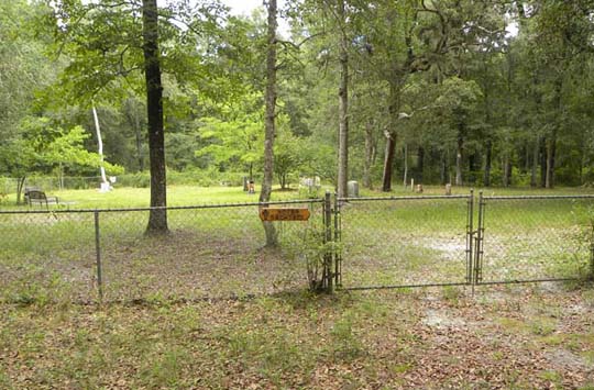
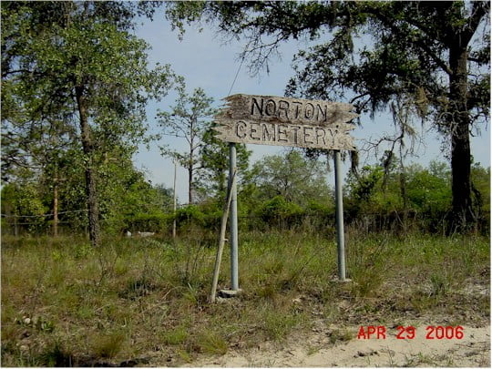
The Norton Cemetery, also known as the Deep Creek Cemetery, is North of Bryceville, Florida. To reach it, on Cr 121, go to 0.5 miles south of the intersection of Hamp Hicks Road and CR 121. The Cemetery is on the East side of CR 121. It is is about 19 miles South of Hilliard on Cr 108 leading to Cr 121, and will be about 0.5 mile beyond Hamp Hicks Road on the left. Norton Cemetery Location (Nassau County)CR 121Bryceville, FL GPS Location 30.456560, -82.002051 The following quotation is on the grave of Noah N. Norton: Death is a gateway we all must pass through to reach that fair land where the soul is born anew, for man’s born to die and his sojourn on earth is a short span of years beginning with birth… And like Pilgrims we wander until death takes our hand and we start our journey to God’s promised land, a place where we’ll find no suffering nor tears, where time is not counted by days, months, or years…. And in this fair city that God has prepared are unending joys to be happily shared with all of our loved ones who patiently wait on death’s other side to open the gate!”. The inventory was made on December 4, 1998 by Jack C. Plemmons and Jan Warren. Norton Cemetery Photographs Photographs are courtesy of the Jean Hodges Mizell collection

Norton Cemetery Read More »

Nelson Cemetery

Nelson Cemetery is located in CCA Block 1140. There is no public access to this cemetery. Contact Smurfit-Stone or Rayonier Corporation for information regarding access. Nelson Cemetery Location (Nassau County)CCA Block 1140FL We have no map location or GPS for this cemetery This survey was made in May 1993 by Ann Duff, Shirley McCabe, and Joan Johnson.

Nelson Cemetery Read More »

Nathalene Primitive Baptist Church Cemetery

From Hilliard, take CR 108 West. Go past the school. CR 108 makes a sharp left next to a Minit Market. Take the first paved road to the right, Bay Road, about one block after the market. Go 3.1 miles to Conner Nelson Road and turn right. Go 1.5 miles to Nathalene Drive and turn right onto dirt road to church. The cemetery is behind the church and is enclosed by a chain link fence. Nathalene Primitive Baptist Church Cemetery Location (Nassau County)Nathalene DriveHilliard, FL 32046 USA GPS Location 30.702655, -82.003495 This inventory made on May 17, 2001, by Jean Mann, and published in The Nassau Genealogist quarterly Vol. XI, #1 Winter 2004 The cemetery was surveyed by LDS Church in 1956. Click here to see LDS survey.

Nathalene Primitive Baptist Church Cemetery Read More »

Mount Olive Cemetery

This cemetery is in King’s Ferry Florida. To reach it, from the intersection of Lessie Road and Middle Road, take Lessie Road back towards CR 108. Go 4/10 mile to Mt. Olive Road. Turn on Mt. Olive Road and continue until you come to the church – approximately 2/10 mile on right. Mount Olive Cemetery Location (Nassau County)49167 Mt Olive RdHilliard, FL 32046 USA GPS Location 30.782344, -81.829786 This cemetery inventory was completed by Kenneth Sturges on April 26, 1998.

Mount Olive Cemetery Read More »

Abram Isabel Mott Cemetery and Plantation Monument

Mott Cemetery

This cemetery is located north of Hilliard on US Highway 1, turn right on Murhee Road, and go 1.2 miles to a locked gate on the left side of the road. This cemetery is on Rayonier land about .44 miles further inside their property. A visit requires Rayonier permission which must be obtained from their US Forest Resources group, Coastal Resources Unit located at 851582 US Highway 17 North. The list of burials is derived from three sources: Physical surveys by the Amelia Island Genealogy Society in 1995 and 2012, WPA Graves Registration data, and contributions of Eunice A. Mott and Wayne Wingate, which supplies additional burials and the family relationships. Mott’s contribution is contained in the Nassau County Genealogist, Vol. IX, #2, Spring 2002. Thirty three graves are listed, including thirteen wooden markers containing no information. A member of the Mott family states there are also graves outside the fenced area, which are possibly graves of slaves who died on the plantation. Two Civil War soldiers, Burton Lemuel Mott and James I. Johnson, in addition to Isabel and Abram Mott are buried here. Some surveys have called this the Henry Davis Cemetery. Mott Cemetery Location (Nassau County)Murrhee Road in Timber LandHilliard , FL 32046 USA GPS Location 30.736778, -81.931278 Mott Cemetery Burials The first AIGS survey was made by Shirley McCabe and Joan Johnson in 1995, and a 2012 survey was completed in May of 2012 by Jim Miller and Michael Toomey in association with Wanda Arnold, Jasper Griffin

Mott Cemetery Read More »

Motes Cemetery

Motes Cemetery

This cemetery is near Baldwin Florida. To reach it from Callahan, take US 301 south to CR 119 at Bryceville, Go right (west) to CR 121. Turn left (south) and go about 1 1/4 miles to a dirt road on right. Turn right and go about 1/3 mile to the end. A residence is on right. The cemetery is laid out facing east with the gate on the east side. For the latest 2014 survey, the cemetery was divided into in XY grid with four divisions, A1 (100 X 100ft), A2 (50 X 100ft, B1 (100 X 50ft) and B2 (50 X 50ft). Most of the burials are in Division A1, but all grave locations are identified by Division and XY location. There is one fenced plot with four graves, only the grave of Eliza Grand has a full headstone with name and date, and this fenced area has been arbitrarily named the Grand plot. Motes Cemetery Location (Nassau County)Glidden LaneBaldwin , FL USA GPS Location 30.394734, -82.038106 The cemetery was inventoried on December 4, 1998 by Jan C. Plemmons and Jan Warren, following an earlier survey by Yuvonne Phillips Johnson in 1986 which identified two other graves not now identifiable. Lori Bragg also did a survey. The latest photographic survey was completed in July 2014 by Danny Mallard. Motes Cemetery Layout

Motes Cemetery Read More »

Mill Creek Primitive Baptist Church Cemetery

This cemetery is south of Hilliard. To reach it from Hilliard, take St. George Road (CR121) and proceed south for 9 miles. Turn right and go 2/10 mile to the cemetery on right. Graves were inventoried in order, but no layout exists for the cemetery. Alternatively, go the junction of CR 121 and CR 108, south west of Hilliard FL. Follow Carrol Corner Rd. 0.2 miles and the cemetery is on the right. Mill Creek Primitive Baptist Church Cemetery Location (Nassau County)2936 Mill Creek Rd.Hilliard, FL GPS Location 30.606267, -82.001412 The cemetery was inventoried December 4, 1998, by Jan C. Plemmons and Jan Warren. Nassau County Appraiser PID 10-2N-23-0000-0010-0000

Mill Creek Primitive Baptist Church Cemetery Read More »

Scroll to Top