Dennis Partridge

Dennis N. Partridge has been conducting personal research into his family since 1980. In 1996, in the infancy of the Internet, he morphed into a web developer bringing with him his passion for genealogy. Today, Dennis owns and operates AccessGenealogy (https://accessgenealogy.com/), one of the largest, privately owned genealogical websites online, well-known and frequented by Native American family researchers. Dennis also serves as President and Webmaster for the Amelia Island Genealogical Society. He specializes in breaking down brick walls, Native American ancestry, New England ancestry, and French-Canadian ancestry. However, his knowledge is broad enough to answer (or find the answer) to any geographical area.

Hughes Jones Cemetery

This Cemetery is located in Yulee Florida. To reach it, go to the intersection of US 17 and A1A, go north on US 17 to Pages Dairy Road. Turn right on Pages Dairy Road, then right on Florida Avenue. This cemetery is known locally as the Yulee cemetery in addition to being called the Hughes cemetery. The Jones portion of the cemetery is in a large fenced-in plot of in the southwest corner of main Cemetery, it is really a privately owned cemetery whose owners chose to remain independent. The main Cemetery is divided into sections for the inventory but no layout was provided. Hours: Sunrise to sunset. Hughes Jones Cemetery Location (Nassau County)86247 Palmetto StreeetYulee , FL 32097 USA GPS Location 30.635379, -81.599579 Inventory made December 2, 1998 by Jeri James, Jan Warren, Ken and Nancy Sturges, Jan Plemmons . An earlier inventory was made in October 1993 by Connell Jenkins, Joan Johnson and Shirley McCabe.

Hughes Jones Cemetery Read More »

Hilliard Community Cemetery

The Hilliard Community cemetery is located in Hilliard. To reach the cemetery, go north on US 1 past the traffic light in the center of Hilliard for approximately one mile. The cemetery is located on the right beside the church. Hilliard Community Cemetery Location (Nassau County)552056 US 1Hilliard , FL 32046 USA GPS Location 30.699293, -81.922678 This cemetery was inventoried November 22, 1998 by Kenneth Sturges and Jan Warren.

Hilliard Community Cemetery Read More »

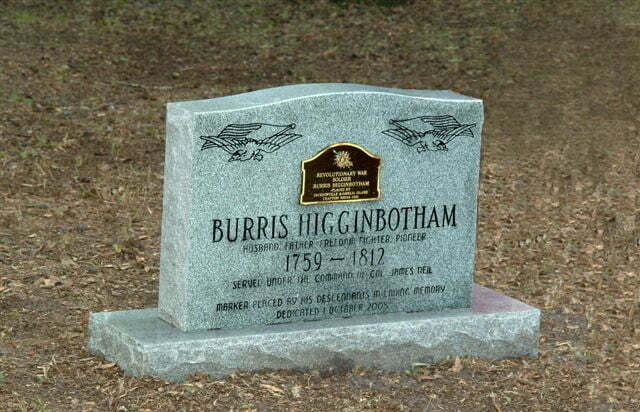
Burris Higginbotham Grave 1759-1812

Higginbotham Family Cemetery

The Higginbotham Family Cemetery is located on the private property of the estate of Linton L. Owens Jr., Evergreen, Florida, approximately 1/2 mile from the southeastern terminus of Owens Cutoff Road at Nassau County Highway 108. When driving northeast, CR 108 takes a right turn. Continue straight ahead across the cattle guard and follow the road to the Owens farmhouse. The house and outbuildings can be seen from CR 108. Higginbotham Family Cemetery Location (Nassau County)57200 Lazy Acres LandEvergreen , FL 32097 USA GPS Location 30.706081, -81.732803 A survey of the cemetery was made by L. L. Owens, Jr. on October 18 1979. Kenneth and Nancy Sturges evaluated the cemetery again in March, 1998. Burris Higginbotham Grave Dedication Burris Higginbotham, is buried in this cemetery. He was a soldier in the Revoutionary War, and the owner of large tracts of land in Northern Florida and Southern Georgia. In a letter to Helen B. Hodges, of Callahan in October 1979, L. L. Owens describes the events of Burris Higginbothams’s burial at the cemetery. “At the time of the funeral and burial, there was lot of rain, causing the water in the Little St. Mary’s river swamp to be unsually high. They had to cross this water with horse and wagon with the body of Burris Higginbotham. There were afraid the body of the wagon with the body of Burris would float down stream, so they cut a good size tree, taking two cuts of the tree, nailing them together and floating

Higginbotham Family Cemetery Read More »

Haddock-Libby Cemetery

The Haddock-Libby cemetery, also known as the Haddock Cemetery, is located in Kings Ferry, Florida. To reach the cemetery, go north approximately 71/2 miles on County Road A121 off Cr 108 between Hilliard and US17. Pass beyond Haddock Road and turn left on a dirt road. The road continues through a gate which must be opened (and closed) to pass through. Continue to the end of the road to a clearing. The Cemetery is on the right. Alternate Route: From the intersection of Kings’ Ferry of CRA121, go south for 2.1 miles, turn right on the dirt road; open the gate and continue to the clearing. Cemetery is on the right. This is a large cemetery with many graves, including six Civil War graves. The graves are listed by rows, numbered from north to south, and reading from east to west. A grave marked R13, #1 for example is in row 13, the first grave in this row. Haddock-Libby Cemetery Location (Nassau County)No addressKings Ferry, FL USA GPS Location 30.760844, -81.829745 This cemetery was inventoried February 17, 1996 by Mary, Nelson, Marguerite Froscher, and Jean Mann. It was updated in March of 1998 by Kenneth Sturges.

Haddock-Libby Cemetery Read More »

Green Pine Cemetery

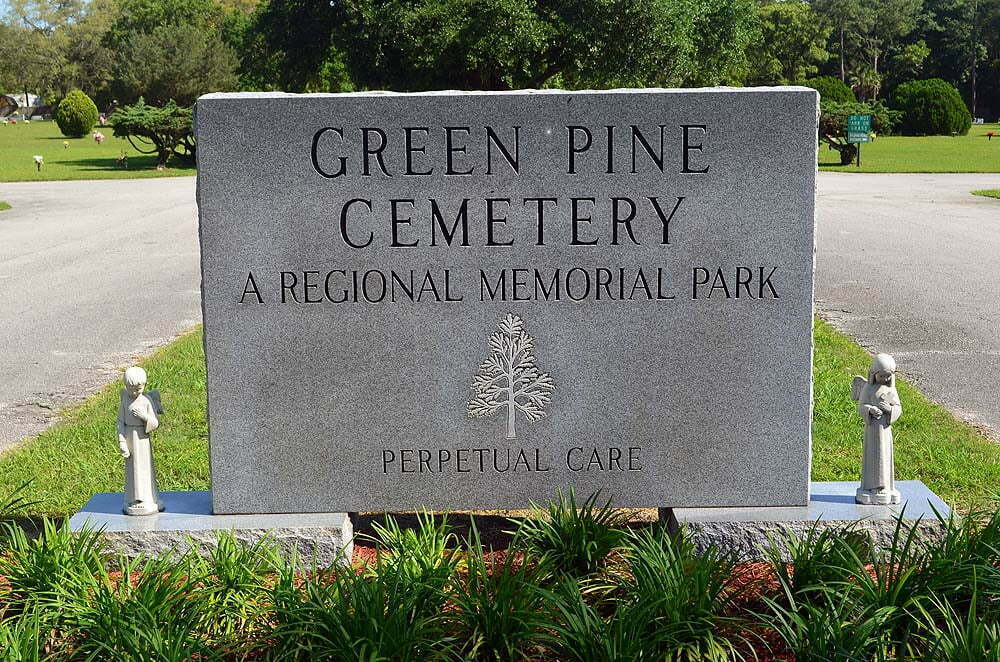
Green Pine Cemetery

The Green Pine Cemetery is located in Chester Florida. To reach it, from the intersection of A1A and Chester Road, east of Yulee, go north on Chester Road to Green Pine Road, turn right. Look for the cemetery on the left. This is a perpetual care cemetery, and is privately owned and operated. Green Pine Cemetery Location (Nassau County)96281 Green Pine RoadYulee, FL 32097 USA(904) 261-0876 GPS Location 30.660934, -81.537330 The Green Pine Cemetery was inventoried in April, 1993 by Joan Johnson, Shirley McCabe and Connell Jenkins.

Green Pine Cemetery Read More »

Geiger Family Cemetery

The Geiger Family Cemetery is located on land now owned by the First Baptist Church of Jacksonville, Florida, which is used as a Retreat Center. Permission must be obtained to visit the cemetery. The Retreat Center is located 3.3 miles north of the intersection of CR121 and Tomlinson Road. The Geiger Family Cemetery is surrounded by a chain link fence and can only be reached with permission and guidance from the caretaker of the First Baptist Church Retreat Center. There are only two tombstones remaining, but there is indication of many other graves due to the sunken condition of the ground with the depressions in an orderly fashion. Tradition is that there were a number of Civil War soldiers buried here whose burials were never registered. It is unknown if these were Confederate or Union. Both Geiger markers are made of unpolished marble. Geiger Family Cemetery Location (Nassau County)Retreat Acres RoadHilliard, FL 32046 USA GPS Location 30.672884, -82.036569 This cemetery was inventoried August 22, 2001 by Mary Nelson and Jean Mann, and earlier by Lori Bragg.

Geiger Family Cemetery Read More »

Cooner-Wingate Cemetery

The Cooner-Wingate Cemetery is located North of Evergreen. The Florida Master Site File states there were 25 graves in 2004. We have records for only 18 people interred there. Go North from Yulee on US 17 for one mile past the Weight Station. The Agricultural Inspection Station is on the right, turn left on Owens Farm Road. Go 5/10 mile, turn right onto a dirt road. You will see the sign for “White Oak Plantation.” Follow this road 1/2 mile west until you come to the “White Oak Plantation Gatehouse.” Just before you reach this house, turn left and continue south 4/10 mile, turn right and go 2/10 mile. The cemetery will be directly in front of you. White Oak Security request that you call in advance (904) 225-3253 and check-in at the gatehouse on arrival.  The pin on the map is GPS from Florida Master Site File. The earliest known inventory of the cemetery was the LDS (1956) inventory of ten gravesites. Cooner-Wingate Cemetery Location (Nassau County)Off Owens Farm RoadWhite Oak, FL USA GPS Location 30.7262980, -81.7217090 The Cooner-Wingate Cemetery contains two CSA graves. Inventoried by Kenneth Sturges in February 1998. Florida Master Site File ID NA01000, Established circa 1877, Graves = 25

Cooner-Wingate Cemetery Read More »

Conner-Green Cemetery

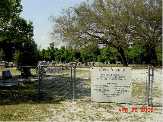
Conner-Green Cemetery

Established on property owned by Richard Green in the mid-1800s, the cemetery was originally known as the Green cemetery. The first grave that can be authenticated is for Rhoda Hunnicut Green, wife of James R. Green, the brother of Richard Green. In 1931, the name was changed to Conner-Green when one of the descendants married Frank Conner. Since Richard Green had no heirs, the property was inherited by James R. Green and his descendants. In 1931, Elizabeth Tanner Green, widow of Noah S. Green, deeded the cemetery to Nassau County and the State of Florida for cemetery purposes for the descendants of Noah S. Green and Frank Conner. Additional property was later donated for use as a parking lot by Tom Crawford, whos family members were buried in the cemetery. The cemetery has been maintained by the members of the Conner and Green families. A numerical order is shown for the graves but no layout is provided. Conner-Green Cemetery Location (Nassau County)2476 County Road 2Bryceville, FL 32046 USA GPS Location 30.527281, -82.007537 This information was provided by Sippie and Carl L. Green.

Conner-Green Cemetery Read More »

Chester Cemetery

The Chester Cemetery is located in Chester Florida. To reach the cemetery turn off A1A, going north on Chester Road. Follow Chester Road to intersection of Blackrock Road. Turn right on Blackrock Road, go around the curve. The Church of God is on the left side of the road, and the cemetery is on the right opposite the church. Chester Cemetery Location (Nassau County)1621 Blackrock RoadYule, FL 32097 USA GPS Location 30.679419, -81.537456 Inventoried in September 1995.

Chester Cemetery Read More »

Buford Grove Cemetery

Buford Grove Church became a member of the St. Mary’s Association in 1887, but it is thought that services were held at least ten years before this association when the recorded membership was 47 members. The land on which the church is located was deeded to the trustees by Henry and Isabelle Davis on 18 July 1904. In 1934, land the Davises had donated for a school was deeded back to the church by the Nassau County School Board. An additional five acres was purchased in 1954 from Mr. and Mrs. Eustis Loyd. The church left the St. Mary’s Association in 1924 and became affiliated with the Fundamental Baptist Fellowship. Early pastors included Daniel Sikes (1891), D. C. Andress (1899), Theodore Davis (1905), Mac McDonald (1917), Willie Sanders (1923), Dr. A. L. Kennan (1924), J. W. Caines (1925), W. E. Hall (1926), E. R. Bowers (1938), J. E. Murhee (1951) and S. H. Stewart who served for 35 years from 1961 to 1996 when he retired. An additional one acre of the church property is being used as cemetery space since the old cemetery is full. The inventory was made beginning with the section behind the community hall (site of the original church) at the westernmost part of the cemetery and beginning with the grave closest to the road. Graves a numbered by row, and by number in the row, so a grave located as Row 6:7 Would be in row 6, grave number 7. An unpaved access road is

Buford Grove Cemetery Read More »

Scroll to Top