
To reach the Russell Family Cemetery, also known as the Russell Cemetery, from the intersection of SR-200/A1A & US-17 go north 2.61-miles to a gravel road on the left. Turn west onto the gravel road, cross the railroad tracks and take the right fork, timber road 56, to the locked Rayonier Corporation gate. Proceed along timber road RD-56 for 1.07-miles, crossing under the power line at 0.7-miles. You will come to an intersection with two roads on the left, one on the right. Turn right (north) on the dirt road, proceeding to a large oak tree; follow the tracks to the right (east) to the cemetery. It is believed that the family home was located north west of the oak tree.
The cemetery is on privately owned timber land managed by Rayonier Corportation, and access is available only by contacting Russell family representative David E. White at (386) 292-0955 or through Rayonier directly.
The cemetery is within a fenced area approximately 100 X 70 feet, and the burial area seems limited to a 60 X 70 ft area which was surveyed. GPS coordinates of the survey area are included in the attached report.
Russell Family Cemetery Location
(Nassau County)
Timberland, US Highway 17
Yulee, FL 32097 USA
GPS Location: 30.6589166, -81.647528
Russell Family Cemetery Interments
| wdt_ID | Gravesite Id | Photo | Individual ID | Salutation | First name | Middle name | Last name | Nickname | Generation | Maiden name | estimated birth date | Birth month | Birth day | Birth year | Death month | Death day | Death year | Note | Revision | Cemetery name | Cemetery ID | Cemetery zone | Taxonomy 1 | Taxonomy 2 | Taxonomy 3 | Taxonomy 4 | Gravesite note | Gravesite revision | Details |
|---|---|---|---|---|---|---|---|---|---|---|---|---|---|---|---|---|---|---|---|---|---|---|---|---|---|---|---|---|---|
| 13,253 | 13253 | 630153 | John | O | Russell | 0 | Jan | 15 | 1855 | Aug | 3 | 1910 | Russell Family Cemetery | 1070 | New | 28 | 3 | John Russel Inscription on East side. Single Headstone for John and Hollie Russel. | More details | ||||||||||
| 13,254 | 13254 | 630154 | Hollie | S | Russell | 0 | Dec | 8 | 1869 | Dec | 22 | 1909 | Russell Family Cemetery | 1070 | New | 28 | 3 | Hollie S Russel Inscription on North side. Single Headstone for John and Hollie Russel. | More details | ||||||||||
| 13,255 | 13255 | 630155 | Elva | Clark | 0 | Apr | 4 | 1890 | Sep | 25 | 1908 | Wife of J. D. Clark | Russell Family Cemetery | 1070 | New | 31 | 15 | More details | |||||||||||
| 13,256 | 13256 | 630156 | Janie | E | Wilson | 0 | Jun | 12 | 1881 | Oct | 20 | 1902 | Russell Family Cemetery | 1070 | New | 38 | 15 | Inscribed "Wife". | More details | ||||||||||
| 13,257 | 13257 | 630157 | Phineas | Johnson | 0 | 1827 | 1903 | Russell Family Cemetery | 1070 | New | 33 | 44 | More details | ||||||||||||||||
| 13,258 | 13258 | 630158 | Mary | Vaughan | Johnson | 0 | 1830 | 1901 | Russell Family Cemetery | 1070 | New | 30 | 44 | More details | |||||||||||||||
| 13,259 | 13259 | 630159 | Lanie | C | Richardson | 0 | Jan | 22 | 1891 | Nov | 24 | 1920 | Russell Family Cemetery | 1070 | New | 19 | 55 | At Rest | More details | ||||||||||
| 13,260 | 13260 | 630160 | Henry | S | Richardson | 0 | Jul | 29 | 1879 | Feb | 16 | 1910 | Russell Family Cemetery | 1070 | New | 16 | 55 | Tho Lost to sight, To memory dear. | More details | ||||||||||
| 13,261 | 13261 | 630161 | Thomas | B | Russell | 0 | May | 28 | 1926 | Russell Family Cemetery | 1070 | New | 10 | 39 | Military headstone | More details | |||||||||||||
| 13,262 | 13262 | 630162 | John | W | White | 0 | Sep | 14 | 1890 | Jun | 30 | 1941 | Died in Jacksonville FL. Obituary July 3, 1942, Times Union | Russell Family Cemetery | 1070 | New | 10 | 28 | Two headstones for the John White with different death dates. The June 30 1941 Date is correct. The original stone is hand made in cement, and about 8 ft west of the new marker. | More details | |||||||||
| 13,263 | 13263 | 630163 | David | B | Wilson | 0 | Jun | 13 | 1837 | Jul | 27 | 1911 | Russell Family Cemetery | 1070 | New | 9 | 9 | Inscription on North side of stone. Two grave together, one combined headstone | More details | ||||||||||
| 13,264 | 13264 | 630164 | Addie | O | Wilson | 0 | Aug | 6 | 1847 | Nov | 24 | 1910 | Russell Family Cemetery | 1070 | New | 9 | 9 | Inscription on East side of stone. Two grave together, one combined headstone | More details | ||||||||||
| First name | Last name | Maiden name | Birth year | Death year |
Gravesite Id:
Photo:
Individual ID:
Salutation:
First name:
Middle name:
Last name:
Nickname:
Generation:
Maiden name:
estimated birth date:
Birth month:
Birth day:
Birth year:
Death month:
Death day:
Death year:
Note:
Revision:
Cemetery name:
Cemetery ID:
Cemetery zone:
Taxonomy 1:
Taxonomy 2:
Taxonomy 3:
Taxonomy 4:
Gravesite note:
Gravesite revision:
Twelve graves were located, all marked with headstones or crosses, with two additional depressions located which might also be graves. The full survey can be viewed by following this link: Russell Family Cemetery survey report prepared by Jim Miller.
The survey was completed on 26 July 2012 by Marie Santry, David White, Michael Toomey and Jim Miller, and a photograph of this team is shown on this page.
Russell Family Cemetery Photographs
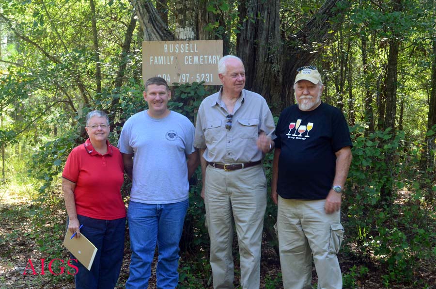
Russell Family Cemetery survey team in front of sign 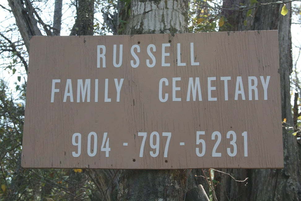
Russell Family Cemetery sign